The North West Route


Friday 16 September

4 degrees this morning and totally freezing in the van so on went the heater. Packed up fairly quickly and headed off for a 4 hour drive to the very north of Scotland. Much is made of John O'Groats being the most northern tip however on the map Dunnet Head seems to pip it at the post, so that's where we're heading. Plus there's a Caravan Club camp site there and not much at John O'Groats.


Near Dunnet Head is Thurso, which is the start of the North West Tourist Route, which runs from Thurso in the far North East of Scotland, to Durness in the far North West, and then down the West Coast to Ullapool, through some of the most remote mainland areas in the United Kingdom. Having travelled up along the East Coast to Dunnet Head, we will basically do a complete loop of the top of Scotland. First we have to get up to Dunnet Head.

The road out of Cannich was one lane with “Passing Places” but we had a few hairy moments with vehicles coming the other way and were very glad when we finally turned onto a major road.


Going over a long bridge over the Crommarty Firth, we could see some oil platforms in the Firth in the distance. This area was opened in 1972 and are an important north sea oil service centre, fabricating and maintaining the rigs, and there is always one or two in harbour. They tower above everything else, and while the region welcomes the related income, they also lament the eyesore factor.


Once we reached Golspie we were on the coastal road. It's quite a windy day but we guess this area gets a lot of wind continually, judging by the direction the trees grow. The country is absolutely gorgeous with lots of green fields and enormous trees.


We stopped at Brora for lunch and then continued on towards Wick. Much of this area was once home to the Crofters from around 1746. Following the Jacobite defeat at the hands of the English, Clans had been forbidden to have chiefs, forbidden to wear tartan, play the bagpipes or own firearms of any kind. They no longer had a need for large tenantry and encouraged emigration to America from the early 1800s. Some tenants were forceably moved to tiny plots to farm as Crofters (tenant farmers). So driving along this area we saw many small stone houses, abandoned and in states of ruin.


Incredibly, we also saw a lot of fanatical people riding bicycles along the road. Some with full protective gear on but some with just lycra shorts and tops. In this wind and rain we're not sure how much fun that must be.


Once at Wick our GPS took us inland so we didn't get to John O'Groats and will have to come back tomorrow.


Arriving at our camp site, the Dunnet Heads Caravan Club Site, it is a fantastic location right on the edge of the cliff with a long beach below and great view of the headland. However with the cold weather, wind howling and intermittent heavy rain, we'll be staying in with the heater on. We put the gas fired central heating on tonight, as it is going to go down to 4 degrees tonight.


Saturday 17 September

Overcast, rainy and windy today but it's a balmy 11 degrees. The day starts badly with Australia losing to Ireland in the Rugby World Cup – Bill may have to draw upon his irish heritage if this continues. So we drive to the Dunnet headland for a look at the most northerly point of the mainland of Great Britain.


There's a lighthouse built in 1831 by the grandfather of Robert Louis Stevenson and many buildings in ruin built during World War II as minor fortifications. The weather was so dismal that we just drove to the different points without getting out of the vehicle. We saw about 6 campervans from France obviously doing a group tour of Scotland, similar to what we saw in Champagne with the American tourists.


The next stop is the village of Mey where the Queen Mother has what was her Autumn residence - the Castle of Mey - since she bought it shortly after being widowed in 1952. We stopped to look at the outside, and to have scones, cream and jam, but we skipped the castle tour. Apparently Prince Charles now stays here for some time in August every year. It is a small castle and might need some freshening up on the outside but apparently the gardens are magnificent and used to provide all the fresh fruit and veg needed when the Queen mum was in residence.


On towards John O'Groats which got its name in 1496 from Dutchman Jan de Groot who started the ferry service to Orkney. 


He had built an eight sided house so each of his eight quarreling sons had their own entrance. This was replicated in the octagonal tower of the much photographed John O'Groats Hotel 1875 but we didn't get to visit as it's actually now being demolished to make way for a new Nature Reserve housing development. The local graffiti artists seemed to have had a field day painting it in garish colours but it was a shame to see this grand old building in such a state.


Visiting the First and Last House (the first and last house you see when you arrive and leave by sea) which is now a museum, it was interesting to see how many ships had run aground around the nearby Island of Stroma. There were also lots of relics from sea and farming life and a German flag that washed ashore following a wreck around 1931.


There really is nothing much to this village and it has received some very average reviews over recent years. It is just a shamble of old buildings. Maybe this new development will bring new life and tourism opportunities. We are sure almost all who visit would be disappointed, and in any case, it is neither the most Northern point of the UK, or the most Eastern point of even this headland.


Our next stop was Thurso which is the most northerly “town” on the British mainland. It's a lovely little place with Victorian architecture and all the modern shops you could ask for as well as a great expanse of beach, again probably more favorable on a nice sunny day. We just had a quick look around, had a coffee, did some grocery shopping then headed back to our camp site.


Not a bad way to spend such a miserable weather day and the bonus was that the overcast conditions kept the temperatures higher – around 14 degrees.


For awhile we've been in Gaelic country so you often see signs written in both languages. There is also Gaelic (pronounced it Garlic) radio and TV and to our delight this year's Edinburgh Military Tattoo was on this evening. The mystery of the parade ground looking smaller then it seemed on TV in years past, is because the stands are new from this year and take up more room. We were actually disappointed with this year's event and think they may have tried too hard to incorporate new acts and it just didn't work for us.

Sunday 18 September

Awoke to a beautiful sunny day and much less cool so went for a quick walk on the beach before heading off for Ullapool. There were millions of worm sculptures all over the beach.  Unfortunately it started to rain lightly on our return to camp and stayed with us most of the morning.


After passing Thurso again, the next town of note is Dounreay which has housed a Nuclear Power Station since 1955, pioneering fast reactor technology and the first nuclear reactor to provide mains electricity. It is now closed but will take until around 2033 and, wait for it, cost 2.7 BILLION pounds to decommission the site.


Lots of single lane roads and peat covered land brought us to Tongue, another crofting village. There is the ruin of Castle Varrich of the Mackay clan from medieval times and a long causeway and bridge across the estuary which seems to have disrupted the 
natural flow of the river.


The landscape on the drive today often looks like it's been burnt, but in fact it's a lot of brown and purple low lying bushes which gives this impression from a distance. We imagine the climate here wouldn't sustain less hardy plants and in winter everything is totally covered in snow. Maybe centuries ago forests covered these areas but today it seems the only trees are those planted in fenced enclosures, scattered about here and there.


As we're still on the coastal road, we are being rewarded with magical sea views on occasion and none more so then at Durness (the most northwesterly village on the British mainland). 


Apparently John Lennon holidayed at nearby Smoo as a kid with his family and returned with Yoko in the 1960s. This deserved a plaque at the village hall which we didn't go to see. We did stop at Smoo though to have a look at the Smoo Cave, a gapping hole in a sheer limestone cliff formed by the action of the sea. It's a bit of a steep walk down to it and as the wind was up we only stayed long enough for a couple of photos but you can take organized canoe rides into the cave.

This was one of the few villages we crossed that was trying to take advantage of tourism with some small shops and cafes and modern accommodation including the perfect vantage point for the caravan park, right on top of a cliff.


The drive then crossed over more highland regions with many mountains providing spectacular scenery.


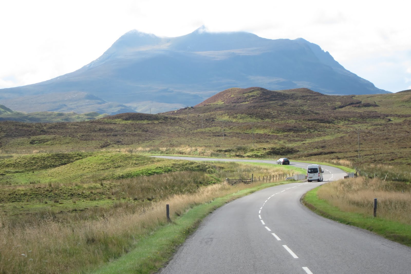
And there odd traffic hazard along the way...


A bonus just before we got to our destination was the discovery of the ruined Castle Ardvreck at Assynt of the Macleod Clan, Bill's ancestors on his mother's side. We didn't think we'd get to see it as the maps were unclear about the location. There isn't much left but an information plaque reveals the castle was quite small and the seat of much mayhem with James Graham the 1st Marquess of Montrose being held prisoner here in the 1650.


Finally arriving at our camp site, Ardmair Point Caravan and Camping Park, after a pretty tough 5 hour drive (single lane roads are quite stressful) we were glad we made the effort as the setting is magical and the weather much warmer (and just quietly, the sun is out). We are right on the edge of a natural harbour with lovely rock beach, surrounded by mountains and quaint white washed houses in the distance.


Monday 19 September

A bit of early rain but the prediction is for mostly overcast as we up stumps for the day and head a couple of miles up the road to the town of Ullapool for a look. Ullapool took off in 1788 at the height of the herring boom and although stocks are now completely depleted, fishing boats still dock here and head further out. There is also a ferry service running to Stornoway on Lewis.


We thought we might be able to get some nice seafood here but alas no. They don't sell fresh seafood and all the menus we saw only had hot and battered offerings.


This is a cute little town with gorgeous white washed buildings, very large harbour with huge mountains pushed up and carved out by glaciers centuries ago, and plenty of shops to brouse in. In the high season it would be bustling and on a sunny calm day it would be very pleasant to sit and soak in the view, but today it's cold and windy so we didn't linger outdoors too long.


Back at camp we donned our “beach outfits” (including thermals) and went for a walk in the afternoon when the sun made an appearance. The beach is covered in smooth rocks of different sizes, testament to the constant pounding by the sea. Making it to the end of the stretch we went to have a look at an abandoned stone cottage currently for sale.  You can have it with offers sought over£80,000.  There is a bit of construction going on in the area and it really is a beautiful spot.


Returning to the beach we had a go at making a cairn which is much more difficult then we expected. It wasn't a bad effort but only lasted long enough for a few photos before the wind blew it down.


The weather is quite mad here in the Highlands with the sun coming out a few minutes after a torrential downpour, followed by heavy clouds, strong winds and more rain on and off throughout the day. We just dress for rain whenever we go out to be safe.


Others playing it safe were a couple camping in a tent across the way from us. The tent had almost blown away while they were out for the day so we were glad to see them taking it down for the night to sleep in their van. It wasn't until the next morning we saw they also had 3 dogs with them. Must have been nice and cosy!!

Just one last word for the day on animal lovers. We saw an older couple returning to camp after their day out, taking a birdcage out of the car. They couldn't have left it at camp during the day as it would have frozen in their van, but could it really be fun for it to travel in the car and be left in it while they were out exploring? We love animals, but we really don't get what we've seen on this trip regarding pets.

The North West Route took us through many magnificent areas, that sadly most UK residents don't seem to visit!  More photos here.


Stirling to Inverness


Saturday 10 September

A bit of rain to start but it cleared as we packed up and headed for Stirling, famous for Robert the Bruce and William Wallace.  Our GPS had a few conniptions today as we kept going off track to visit attractions we hadn't planned to see.


The first was the Falkirk Wheel (2002), an ingenious engineering masterpiece allowing the use of canals again as modes of transport after they became unpopular with the introduction of trains. The Wheel is the world's first rotating boat-lift, scooping boats up in two giant buckets and carrying them to the upper or lower canal of the Forth & Clyde and Union Canals respectively.


Next we came to the Bannockburn Heritage Centre, the site (or close enough to) of the battle of Bannockburn between the English army of King Edward I and the Scottish army of Robert the Bruce in 1314. It was this battle that united the Scots under Bruce and led to independence from England. 


Being National Trust members we gained free access to the visitor centre which provided information about the battle including a short film, and then made our way to the Robert the Bruce statue out on the battlefield itself. Surprisingly, just two years after being officially recognised by England and the Vatican as being the rightful King of Scotland, he died at age 55 of what is believed to be leprosy.


In the distance from the battlefield we could see what looked like a castle and assumed it was Stirling Castle, what the English were aiming to reach before the battle took place. What it actually is though is the memorial to William Wallace which we'll visit tomorrow.


Arriving at our camp site, Witches Craig, not a Caravan Club site but still a great site with very good facilities, we were pleased to find it not haunted but surrounded by high mountains and horned sheep or goats (it's hard to tell which they actually are). The day had brought intermittent rain again but the sun came out for a few hours as we set up. But also at the end of the day a cloud of crows came circling above the camp, so maybe there are witches here after all!!!!

Ireland and Scotland are supposed to feel the worst effects of the remnants of Cyclone Katia from Sunday night, which to date hasn't caused any damage anywhere. We'll see how we get on but for the moment there is no wind and the temperature is milder.


We watched the last night of the BBC Proms on TV, always a favourite for us in Oz, and were surprised to know they not only perform in Albert Hall London, but also several locations including Hyde Park, Bangor and Dundee (just up the road from where we are tonight) and do a joint finale simultaneously. Rolf Harris performed in Hyde Park to an adoring crowd, which made us very proud.

Sunday 11 September

It's hard to believe that 10 years have passed since the horrendous 9/11 events in America. Prince Charles attended a service to commemorate the 86 UK citizens who died in the Twin Towers, and Dame Judy Tench read a very moving poem.

We can see the National Wallace Memorial from our Camp Site, so we plan to walk to it today, and then on into Stirling to look at the Stirling Castle. The weather is not great, so we donned our all-weather gear. The remnants of Hurricane Katia are due to hit tomorrow, but the weather is unsettled already.

We completed the walk to the National Wallace Memorial in quick time. The foundation stone for this memorial was laid 150 years ago today. It was built to honour the life of one of Scotland’s favourite sons, William Wallace. It looks like a Gothic church spire - the tower stands 67 metres high, but its position on the Abbey Craig overlooking Stirling makes it stand out for miles around.


The position was selected as it overlooks the fields around where the Stirling Bridge Battle was fought – William Wallace's finest moment – where the Scots forces led by William Wallace defeated the English Army by ambushing them as they were caught crossing the Bridge at Stirling. The English were attempting to relieve their forces who were under siege in the Stirling Castle nearby.


The monument has 3 floors chronicling the Wallace story and the related history of Scotland, with a lookout at the top, all accessed by the one narrow spiral staircase.
Included is William Wallace's actual battle sword – a huge weapon – together with a celebration of those Scots who have made major contributions to the world.


246 steps later, and with the storm bearing down on us, the winds on the lookout at the top of the monument were severe – they will surely have to close this tomorrow when 70 mph wind gusts are expected here. The view even in the wind and rain is great.


After some lunch at the Cafe at the memorial, we walked on into the the town of Stirling, walking over the “old” Stirling Bridge which is located right where the timber bridge stood that was the scene of the battle.


We then walked onto the Stirling Castle, which sits on a ridge overlooking the town. It has undergone major restoration works, being reopened by Her Majesty the Queen just a few months ago.


Some of the restoration is controversial, given the bright colours applied to some of the buildings, and the internal fittings. It felt a little garish to us, but maybe that was because we are used to seeing most like buildings suffering the effects of their age. So to see the internals of such an historic place all freshly restored to what the experts believe was their original state was a bit of a shock – so many bright colours.


After Edinburgh Castle, Stirling Castle struggled to impress us, but in retrospect, it had its own charms, with the Stirling Heads (ceiling decorations), the many statues adorning the exterior and the large Great Hall. The Castle played a most strategic role in the defence of Scotland, given it's key position guarding most routes to the North, which set the scene for the Battle of Stirling Bridge, and the subsequent Battle of Bannockburn, which we visited yesterday.


We were done in by the time we completed the hour walk back to our camp, but we both really enjoyed the day, in spite of the weather.


That black cloud of crows returned to circle above. Spooky.  Spooky cows too.

Monday 12 September

The winds are a little stronger this morning, and the campervan is being blown about standing  still, so as we packed up to head up to the north-east to Aberdeenshire, away from the worst of the storm, to ride out this weather system. 


The drive took us into the Cairngorms National Park close to the Grampian Mountains, which were lost up in the clouds.  Some of the roads our GPS sent us down were a little tight, especially when a large truck came the other way and we nearly ended up in the left bank. Luckily champion driver Bill reacted with precision. Apart from that little incident we did enjoy the beautiful, green countryside and seeing so many fat, healthy black cows (pitch black) and sheep in the fields. At one point, going up into the mountains a little, we could see small blocks of ice on the roadside which is totally amazing and unexpected at this time of year, isn't it?!


Arriving at our camp site, the Huntly Castle Caravan Park at Huntly (capital of Strathbogie, half way between Aberdeen and Inverness) along with some rain we were happy to see the area is well protected and we shouldn't have too much trouble with strong 80 mile p/h winds other parts of the country are experiencing this afternoon.


After lunch we took the short walk to the nearby Huntly Castle ruins which was once home to George Gordon, The Earl of Gordon in the 14th century. The Clan Gordon were supporters of both William Wallace and Robert the Bruce (who stayed in the castle in 1307) and took part of different battles with them against the English. This is interesting to us because we are great friends with some Gordons who sing their “Gordon For Me” song whenever there's a family gathering.  The song being performed by Kenneth McKellar is here, and the "insightful" lyrics are here.  A true classic.


This is our first castle ruin and it was very impressive. You can actually climb up into the preserved parts of the castle to get an idea of how it would have looked. A few original pieces of plaster and two fireplaces are behind glass to further preserve their impressive detail. Once again we saw very modern loos for those times and the obligatory prison in the basement level. It was totally great and located amongst beautiful tall trees, green fields and a nearby rushing river.


We're starting to understand the weather here. It pretty much rains all the time though generally not heavily or for long periods, so we're constantly putting up the brolly then taking it down again a few minutes later. We're very glad we bought those rain trousers in Kalma Sweden as we'll get very good use from them here.


This camp site is also home to a huge family of rabbits who have built their burrows throughout the grounds so you see them hopping about everywhere. Hope we can get some photos of them because they're totally cute. Nope, just more sheep/goats.


One of our favourite British comedians, David Walliams of “Little Britain” fame, has for the past 8 days been swimming the River Thames from Gloucestershire to London (140 miles) to raise funds for Sport Relief. Along the way he rescued a Labrador who had fallen into the Thames and also suffered from Thames tummy (imagine why) but today he finally made it and raised over 1 million pounds for his efforts.


Tuesday 13 September

There was a little strong wind overnight but nothing compared to what some of the country experienced. One person died when a large tree fell on their car and 15 cars were damaged when a large carport collapsed due to the winds. There was also some flooding in some Western coastal areas. Today everything seems to be back to normal wind wise but it is a little cooler and showery.

We packed up and headed for the Caledonian region to visit two National Trust of Scotland sites. The country we drove through was spectacular. Lots of huge pine tree forests, lush green fields amongst the brown of the crops and lots of sheep, cattle and horses. It's lovely to see so many animals compared to the few we saw in Europe.


Our first Trust site was the Brodie Castle from the 16th century. This magnificent building has been the home of the Brodie family the entire time right up until 8 years ago when the last Brodie of Brodie died (he was 90). Due to the enormous cost of up keeping such a building, this last Brodie decided to leave his home to the Trust while he was still alive. In fact when the Trust first opened the Castle for viewing in 1980, the last Brodie often greeted visitors and served as a guide in the upper floors. 


We were taken on a 90 minute tour by an extremely knowledgeable volunteer who explained that the original building was added to in the 17th and 19th centuries. As the Castle had continued to be lived in, all the furniture, paintings, carpets etc were original. The tour started in the library which contains some 6000 books and an original letter (under glass) from the 14th century from King Robert (Robert the Bruce) to the then Brodie with a request to clean up the streams running through the property as the nearby Abbey had lodged a complaint that they were not receiving enough water downstream to power the water wheel that drove their flour mill. Wow! You open a letter from the King expecting an invitation to a Ball, and it's basically a Local Council type directive – except for the final words – basically fix it or it will be dealt with by “other means”. The Brodie of Brodie fixed it.

In the dining room, under a heavily adorned ornate Italian plaster ceiling painted to look like timber, the large table was laid out with two hundred year old China complete with the family crest. The Great Hall in the newer section had large windows to let in the light and the décor was softer. Wedding ceremonies can be held in this room. The room where one of the Brodie wives died in a tragic fire centuries ago had of course been rebuilt but we could only see it from the doorway as it is above the dining room and it is feared too many visitors walking around in this room may cause the dining room ceiling to collapse due to its weight.

Sadly we can't show any photos as they are banned, and there does not seem to be any on the web.  You will have to visit yourself!

After the tour of the interior we were free to explore the outer buildings, one of which was attached to the dairy and had been specifically built to house 12 large pottery bowls to be filled with fresh milk each day and await the separation of the cream to make butter.


The grounds are enormous and contain a large pond down the end of a long walkway. There are no formal gardens but masses of beautiful trees and in spring the lawns are covered in daffodils planted by this last Brodie's grandfather who was passionate about them.

It was so amazing to visit something so old which until 8 years ago had still been used as a principle residence. In fact the Brodie's private section of the Castle (can house 12) is still used today, rented out by the National Trust Scotland, as holiday accommodation.

By this time it was late in the afternoon so we made our way to our camp site, Culloden Moor Caravan Club Site, ate a late lunch then drove to the nearby Culloden Moor battlefield, the scene of the last major battle fought on British soil.


The very impressive state-of-the-art visitor centre provides all the information about the Scottish Prince Charles Edward Stuart (Bonnie Prince Charles, son of James I) and the Jacobites (those loyal to the exiled Scottish King James I) battle against the Government forces lead by the Duke of Cumberland on 16 April 1746. There is a short re-enactment of the bloody battle in a surround sound and vision theatre, plus lots of memorabilia of the time – swords, letters, recovered fragments of canon shots and bullets etc.


Out on the battlefield itself you are provided information about what took place at each strategic location via a GPS guided audioguide. Fantastic.


The Jacobite army had been successful in defeating the government forces until this time, but here they were tired, hungry and the weather conditions unfavourable. On the insistence of the Prince that the battle would take place on this day, they lead the charge. Outnumbered by the government forces, over 1,200 Jacobites were killed within 15 minutes. And many more in the days and months to come as Cumberland tried to snuff out all Jacobites and the possibility of another uprising. The Prince escaped into excile and died many years later, fat and alcoholic, still accepting praise from european nobility of his bold attempt to defeat the English.


In 1944, a Culloden local, Hector Forbes had grave markers of the different Scottish clans erected where they were buried on the battlefield as well as a large Memorial Cairn to honour them. There is one large grave marker for the 50 English soldiers who died that day. In 2005 archaeologists using sonar found two large rectangular areas which are probably the sites of the graves. Excavations are not planned.

Unlike at Bannockburn where the memorial may or may not be the actual site of the battle, these grounds are definitely the site. How amazing to be standing here and so fantastic that the National Trust has bought the land and maintained the memory.

That night we watched another British battle – the 3rd day of the British Cycling Tour. Yesterday's event was postponed due to the strong winds. This Tour is obviously nothing like the French one but we enjoy watching bike races and there is an Aussie or two in the field so we'll see how they go.

Wednesday 14 September

Brrrrrr. It's cold this morning and windy but the sun is out and we eventually emerged from our heated cocoon to catch the bus into Inverness.


On the way in it was amusing to see that Cawdor Castle is not far away either. Sylvi remembered her high school studies of Macbeth and the reference to the Thane of Cawdor. However the Castle was built many years after the events of the play.


After visiting the huge Eastgate shopping centre, Billy had his 3rd haircut of the trip, a bargainous 7 pounds, the best value so far.


The Inverness Castle is not open for public viewing unless you're up before the Sheriff to be heard or pay your dues as it is used as a government building. However it does have an interesting history. A succession of Castles has stood on this site since 1057. The one from 1745 was destroyed by Bonnie Prince Charles' Jacobites, rebuilt in 1836 and is the current one today. From it's high vantage point there is a lovely view over the city and the River Ness below. But we didn't linger too long as the winds were bitterly cold.


Across the River is the incomplete St Andrew's Episcopal Cathedral of 1866. Intended to be one of the grandest buildings in Scotland, funds ran out before the two spires could be added. It is still a beautiful building and the interior is quite impressive with a mixture of stone and wood decorations.


Before catching our return bus home we finished our stroll along the River Ness which is flowing very strongly and currently in flood after a long summer of rain. Here we saw the largest gulls we've ever seen.


Back at camp with a touch of rain only for the sun and blue sky to come out at 7pm to finish off the day. The maximum temperature was supposed to have been 14 degrees today but it felt more like 6 with the wind chill factor. It definitely feels like Brisbane winter temperatures to us.

Thursday 15 September

8 degrees this morning apparently and we're set for a beautiful fine day as we head off for Glen Affric where we plan to do a few nice forest walks.


But first we stopped a short way up the road to visit the Clava Cairns – stone burial mounds dating back to 2000BC. Similar Cairns can be found throughout Scotland but these are said to be the best preserved. There is evidence that these burial chambers were reused centuries later, but generally only one body was entombed in each. Different coloured rocks were used and the entrances built to face the direction of the sun in midsummer. These were totally fascinating and how amazing that they still stand here. Apparently the land owner in the 1800s planted the grove of trees around them to preserve this sacred site.


A short walk up the road we were able to take better photos of the Culloden Rail Viaduct – we would call it a bridge - which is the longest masonry viaduct in Scotland and one of the most spectacular, built in 1898, as part of the great Highland Railway


Setting off again and we're starting to see the changing of the leaf colours to beautiful autumn orange, red and yellow. Really lovely.  Even the deer like it here.


We travelled back south for an hour, along the banks of the famous Loch Ness – no sightings of Nessie though. Arriving at our camp site, the Cannich Caravaning and Camping Site (similar to the other group but not connected) we had lunch then drove to the Glen Affric National Nature Reserve - supposedly the most beautiful Glen in Scotland. The road is a single carriage but there are many “Passing Places” where you can pull over to let other vehicles pass.


There are several carparks attached to the different walks you can do and we headed for the furtherest one in to do a 20 minute short climb and a 50 minute river trail. The view at the top of the climb is magnificent. Up close there were lots of trees with colourful autumn leaves, pine trees and tall mountains (known here as Munros) in the distance and the beautiful rushing River Affric below. There are also a huge number of very large mushrooms which look like they'd be beautiful to eat, fried with garlic butter, but we're sure they're poisonous so they can stay where they are.


The 50 minute river walk was also very pleasant with the reward of the rushing rapids at the end. Many of the rocks showed signs of scrape marks from the glaciers that were in this area thousands of years ago. And feeling the water it seemed like they'd only just passed today, because it was VERY cold. Even a dog out on a walk with his owners couldn't bring himself to jump in though it looked like he really wanted to.


On the drive back out we decided to do one last short walk to a gushing waterfall. Alot of the time you're walking on peat moss so it feels squelchy underfoot and the recent rains have also made the track muddy. But overall, the walks were very achieveable and very pleasant. The scenery is fantastic.


Despite the increasing cold, we will head off tomorrow to the most northerly point in Scotland, before heading back down to the highlands west coast to the Isle of Skye, visiting some of Bill's mother's family (the Clan MacLeod) historical sights along the way.


More photos here.